1.1) Online papers and
publications by B.J.S. Cahill:
Annotated link-list [still in progress]
- All items are on this website and open in separate
windows;
- Chronological by earliest composition date;
- Publication date in boldface.
1909-02 / 1909-09
Cahill, B.J.S., "An Account of a New Land Map of the
World" (The Scottish Geographical Magazine,
1909-09) p. 449-469.
The first publication
and exposition of the Butterfly Map. Strong critique
of Mercator for classrooms.
1912-03-05 / 1913-02-25
Cahill, B.J.S., "Map of the World", U.S. Patent
1,054,2761913 (Washington, DC: United States
Patent Office, 1913-02-25; filed 1912-03-05.) 3 p.
Cahill's patent of
the Butterfly Map itself. Online here as jpegs, pdf,
or HTML.
1912-10 / 1913-10
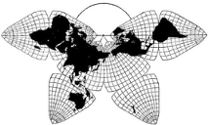
Cahill, B.J.S., "A Land Map of the World on a New
Projection" ( Journal of the Association of
Engineering Societies, 1913-10; orig. 1912-10) p.
153-207
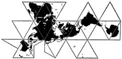
Cahill's longest and
most thoroughgoing published exegisis of his
Butterfly Map; also includes 50 illustrations, 20 of
which are a comparison of various map projections to
the same scale using the same size globe-circle for
each. Over three decades before Buckminster Fuller’s
1943 Dymaxion map, Cahill had already created a far
more elegant octahedral world map, and shown how it
is designed for thinking “planetarily”. Article is
re-formatted in HTML with all the illustrations.
1913-02-11 / 1913-12-09
Cahill, B.J.S., "Geographic Globe" (Washington,
DC: United States Patent Office, 1913-12-09; filed
1913-02-11) 2 p. + extra photo.
Cahill's patent for a
rubber-ball globe which can flatten to a Butterfly
Map, or return to ball shape. Online here as jpegs,
pdf, or HTML.
ca.1920
Cahill, B.J.S., The Butterfly Map: The Surface of
the World Shown on an Eight-Part Decentralized
Projection (n.d., ca. late 1919 or early
1920) 8 p. illus.
Promotional pamphlet
(shown here in 8 jpegs), with
(a) descriptive material and pictures, front and
back pages;
(b) reprints of two of his illustrated articles,
deprecating the Mercator map;
(c) three pages of blurbs from prominent
geographers, educators, and personages of the day
(including two by John Paul Goode, who went on to
perpetrate the Homolosine three years later).
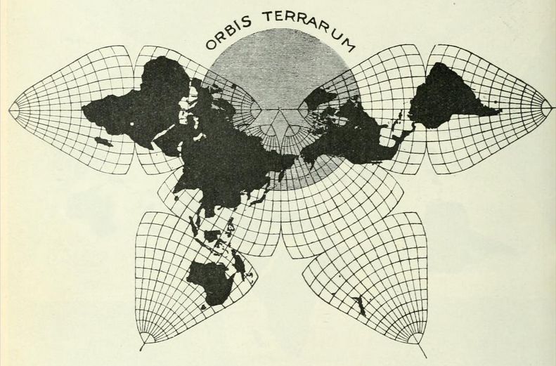
1928-12-28 / 1929-04
Cahill, B.J.S., "Projections for World Maps"
—and text continued in separate pdf, plus
illustrations:—
Cahill, B.J.S., "A New Map for Meteorologists:
Equally Suitable for Small Areas, Continents,
Hemispheres or the Entire World" – both from
Monthly Weather Review, 57/4, 1929-04) p.
128-133; illus.
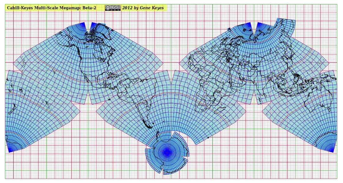
Has Cahill's only
published [partial] world map with a one-degree
graticule, except on land areas; as well, one
of his only published five-degree world maps,
regrettably discontinuous on two pages. See similar
map in [1934] below, octants together, but in
an awkward north-south spread, which I also show enlarged; and cf
[1940] below, in Butterfly layout.
Pdf's are re-posted on my page via
above links for convenience; source URLs were:
http://docs.lib.noaa.gov/rescue/mwr/057/mwr-057-04-0128.pdf
http://docs.lib.noaa.gov/rescue/mwr/057/mwr-057-04-0130.pdf
1934
Cahill, B.J.S., "A World Map to End World Maps"
( Geografiska Annaler, 1934) p. 97-108.
Argues against
proliferation of arcane projections, and sets
forth three major Variants to improve upon his
original design: Conformal, Equal Area, and Gnomonic,
within his basic octahedral framework. "When finally
map and globe practically agree . . . the need of
further world mapping comes naturally to an end."
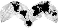
1940-04-03; 1940-05-20
Cahill, B.J.S., "One Base Map in Place of Five"
(1940) Monthly Weather Review, 68/2, 1940-02
[1940-05-20], p.4; 1 illus.
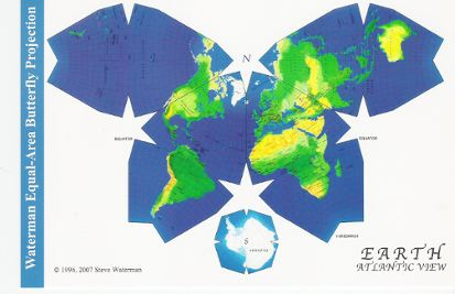
Again urges the
meteorological community to display data on a single
world map, his Conformal Variant. Unlike items 6 and 7
above, here the map is shown in its customary
Butterfly profile, Pacific aspect. This was Cahill's
final article; he died in 1944 after a long illness.
Pdf re-posted on my page via above link for convenience;
source URL was
http://docs.lib.noaa.gov/rescue/mwr/068/mwr-068-02-0041.pdf
|