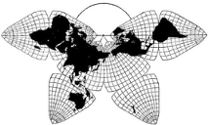
Cahill 1909
| Go back to Gene Keyes home page |
|

|

|
|
Cahill 1909
|
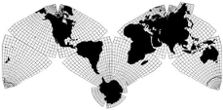
Cahill-Keyes 1975 |
|
Note: being averse to small print, I wrote this in an 8" frame with ca. 12 pt. serif type.
If you are like me, you may wish to enlarge your screen view to a similar size, in case it has a teensy-weensy default.
The Cahill-Keyes Multi-Scale Megamap: Beta-2 Plus new separate page: interactive digital panning and re-sizing via Foxit pdf reader Gene Keyes 2013-01-08 updated: 2013-12-10 Mary Jo Graça's latest Perl script 2nd ed. revised: 2014-01-23 How freeware Foxit pdf reader pans and re-sizes full-scale 1/1,000,000 Megamap
If you
have already seen the 2011-07-01 debut of the Beta-1 Multi-Scale Megamap on my website,
and related links therein, you will recall that they were an intensely-detailed
reprise of how this map was designed by Gene Keyes, then programmed, and generated using a low-end
Asus netbook (plus an Acer notebook), with Perl and OpenOffice.org Draw [now called Apache OpenOffice], by Mary Jo Graça. (The 1975 map atop my Web pages is a long-ago hand-cut and pasted dummy; what is shown in
these subsequent images is Mary Jo's full digital realization of my C-K extended design.)
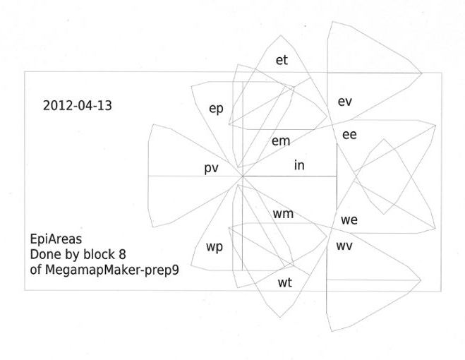
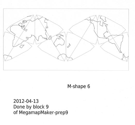
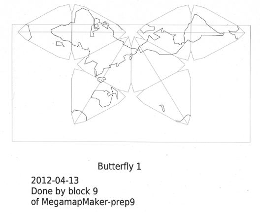
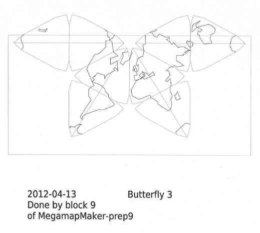
* UPDATE 2013-12-10: Included here is Mary Jo Graça's latest Perl program MegamapMaker-prep9.txt (Note: be sure to right click this link, and "Save As" a .txt file. If your browser tries to read it directly, it will mess up a lot of characters.) This Perl can calculate coordinates for the re-united Antarctica, Kamchatka, and other appendages. (It can also rotate the octants into alternate profiles and layouts; see test images in Appendix 1 near bottom of this page.) Enrico Spinielli, who is working on a D3 version of Cahill-Keyes (still in progress; Antarctica tba), has also posted Mary Jo's program on one of his pages (which you can read directly in your browser). However, MJ's latest OpenOffice revisions are not here yet; her Perl script is what directs a vector drawing program (e.g., the [re-named] Apache OpenOffice Draw) to plot and print a Cahill-Keyes.At this point, Beta-2 is the final "chassis" of the digital Cahill-Keyes Megamap. But that only brings us to the threshold of all that this map could be and do; all the content and cosmetics; numbering and labeling; GIS usage; topical themes; historical mapping; globe and geography education; current affairs; online and on-wall; worlds without end. An essential quality of this map design is that it is all the same basic map no matter what the scale, starting at least at 1/1 million, and reducing or cropping as needed. (That is why, up close, some regions look slanted instead of perpendicular; but every one comes from the same M-shape, standard-profile, Cahill-Keyes Megamap, which, overall, has a conventional north-up alignment.) The Megamap's original is still an odg file from Apache OpenOffice Draw. Due to its 41 MB size, it is very cumbersome to open, move, re-scale, etc.; I am hoping it can be ported to other GIS formats. However, I have been able to save both the full Megamap itself, and its smaller complete derivatives, as pdf files (downloadable at Appendix 2 below) which enable you to pan the whole map with speed and ease, compared to the odg. That is, if you open the pdf in a freeware Foxit pdf reader. My Adobe 9.2 reader was not able to open the king-size Megamap; only the smaller ones. Update 2014-01-23: A year ago I was very pleased that the Chrome browser could render and move and re-scale the Megamap smoothly and quickly, but now it can only view the map up to 67% before the image gets corrupted. Luckily, I found that the freeware Foxit pdf reader can show the whole map at chosen percentages from 1 to 100% or beyond, and unlike Chrome, can pan as well as scroll; panning is far preferable. See full instructions in on separate page linked here. (But just to complicate things, note that Adobe makes a more flexible and better quality print than Chrome or Foxit, from those smaller versions.)After years of seeing online maps full of zaggies and stairsteps, I was pleasantly surprised at how sharp the lines and arcs are in my pdf's: perfectly straight or perfectly curved, whether onscreen or in print. However, I cannot show a huge pdf image directly on a web-page; only a jpeg. Therefore, the following illustrations are screen grabs cropped from pdf images, but saved as jpegs: pretty good, but not quite like a pdf, especially if printed. Scale is going to be a nuisance in this presentation. For decades, I have always been preoccupied with specifying and making vivid a map's exact scale. preferably in a sequence of 1, 2, 5, 10, 20, 50 millionths, etc. But computers, for all their precision, have elastic monitors, depending on pixel size and height, platform, magnification, resolution, and so on. I cannot know whether the maps I have drawn here are the same size and look as the ones which you are seeing. So keep in mind that the length of each background grid square in red does represent 1,000 km, and that the smallest grid squares in grey represent 200 km. For instance, in Fig. 1 below, the red squares of my original pdf are 10 mm long; the map itself is 800 mm long (ca. 16"), and its hard-copy version is 1/100 M. However . . . |
|
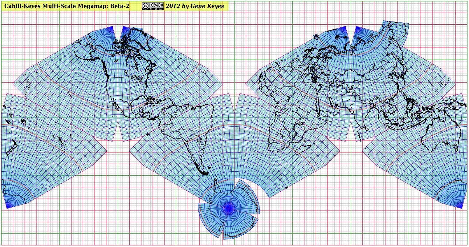
Fig. 1 (below): Full
profile of the Cahill-Keyes Multi-Scale Megamap: Beta-2. The original pdf
is exactly 1/100 million, i.e., 100 times smaller than the full-size 1/1
M Megamap. At any scale whatever, the red squares in its grid always represent
1,000 km. Divide the km (1,000) by a red square's millimeter length (which
at this scale should be 10), and you get 100, or 1/100 million. But suppose
you are seeing that the red squares are 14 mm long on your monitor. Dividing
1,000 km by 14 mm, you get 71, or a larger scale of 1/71 M. Or suppose you
have a smaller monitor or netbook, and the red squares are only 6 mm long.
Divide 1,000 km by 6 mm, and we see that the scale of the map in that case
is smaller, or 1/166 M.
|
|
|
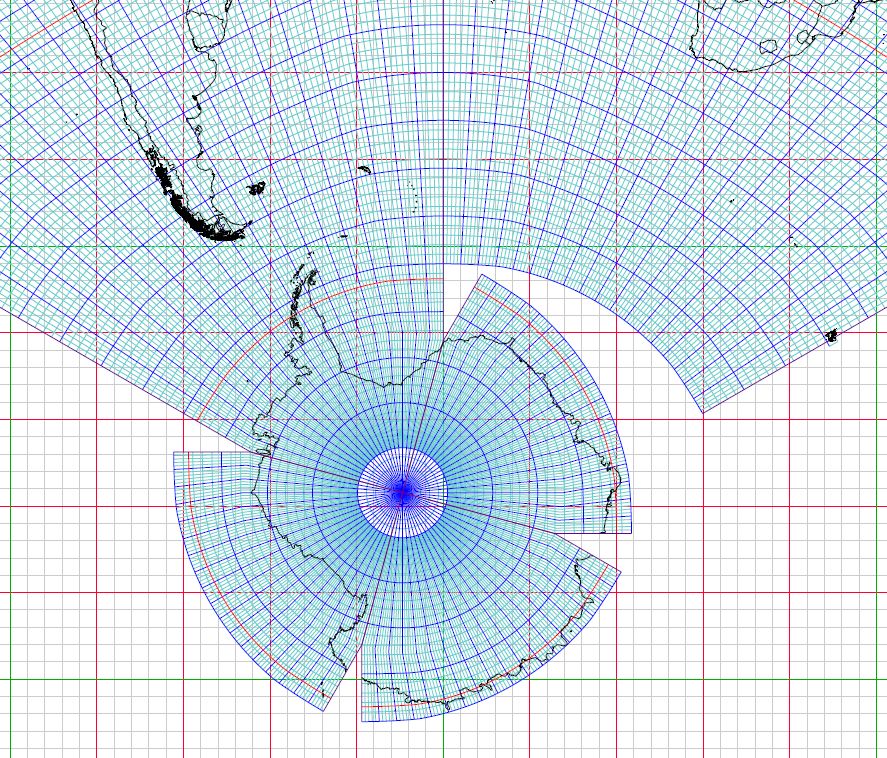
Fig. 2 (below): Antarctica put back together,
and joined to Octant 7, south of South America. This screen grab was made
from a Megamap pdf of 1/50 million, but I do not know what scale your monitor
will show. If your red-square grid lines are 20 mm apart, you are OK, or
else you can try to shrink or enlarge your image. Worse yet, my Mac monitor stretches the image vertically, giving the Antarctic parallels an oval shape, rather than the circles I designed them as. Not a problem on my PC. And I thought Mac was supposed to be for graphic designers. . .
(Notice little Kerguelen Island at the center-right. It will be shown larger in Fig. 9.) |
|
|
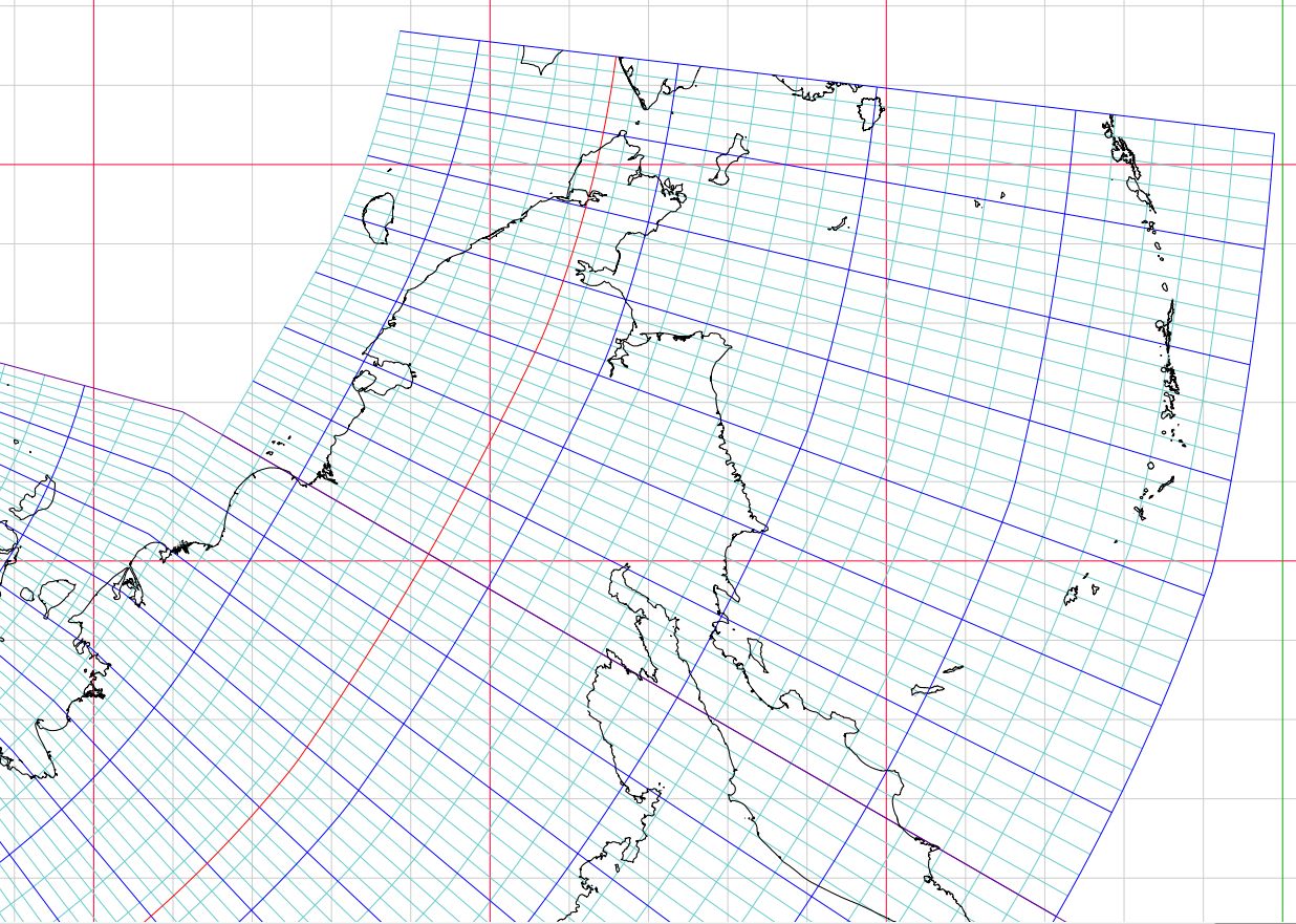
Fig. 3 (below): The other big truncated
chunk in the Beta-1 was the Russian Far East. While in my hand drawn versions,
I always cut and pasted (real scissors, real paste) to extend Octant 4 to include that piece of geography, I never thought
Mary Jo could automate the process without using scissors. Voilà!
This screen-grab is from a 1/10 M pdf, whose smaller grid squares should be 20 mm wide. |
|
|
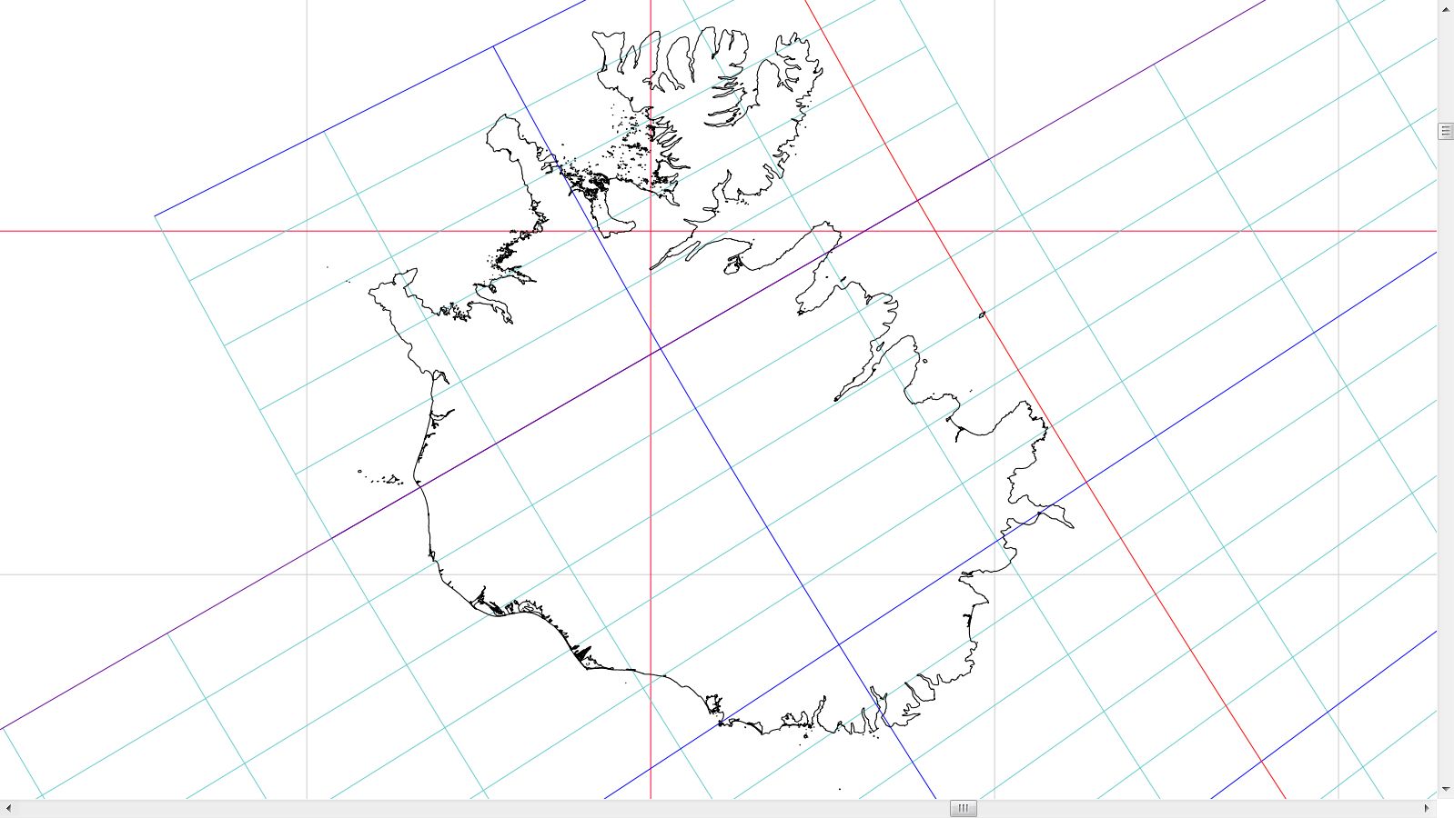
Fig. 4 (below):
Cahill-Keyes Beta-1 split Iceland right down the middle. As with others here,
in hand prototypes I would paste in an extension tab; but again, Mary Jo
let the computer do the walking. The design question is whether to link Iceland
to Europe, or to Greenland; or both. I chose Europe. This is Iceland, screen-grabbed
right out of a half-size, Megamap pdf, 1/2M. The square grid lines should
be 100 mm apart.
|
|
|
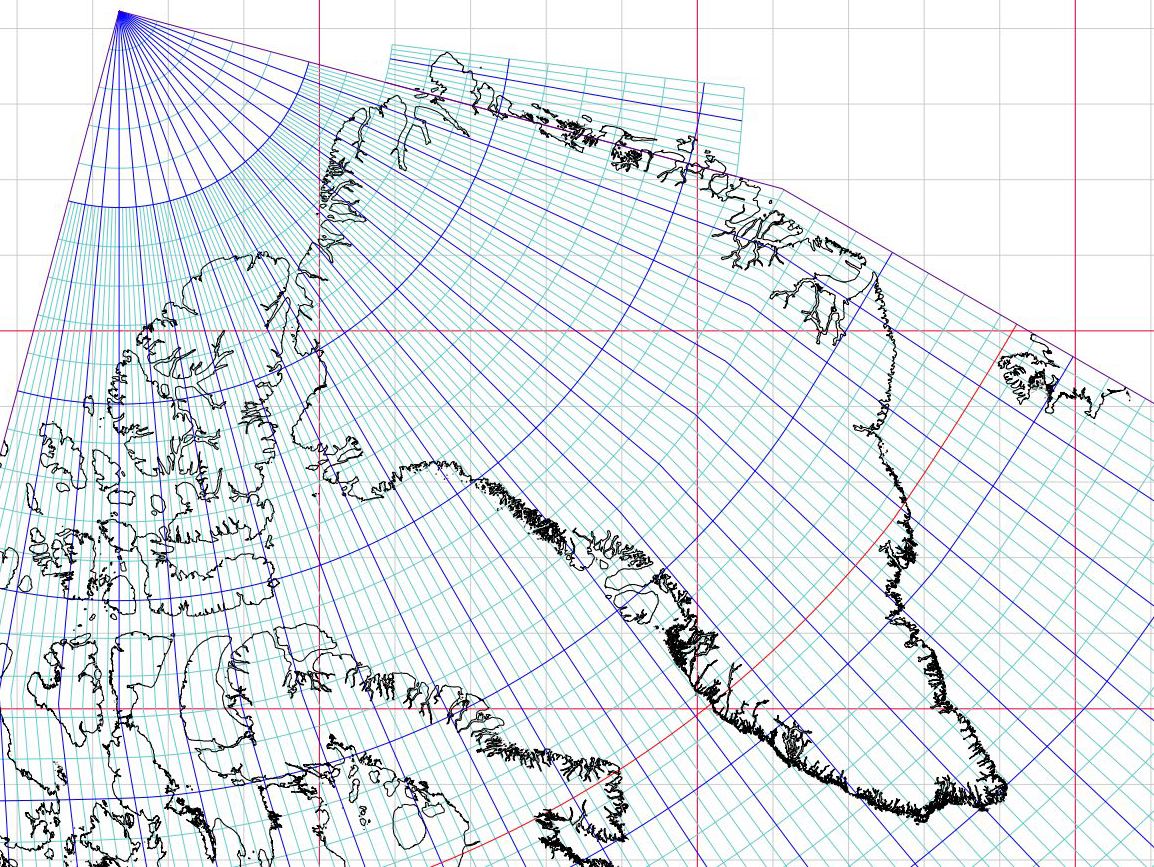
Fig. 5 (below): In
Beta-1, Greenland got a shaving nick, so I added a tab-extension: eight geocells
eastward, 9 geocells northward. Like the Russian Far East map, the original
pdf for this is 1/10 M, whose small grid squares should be 20 mm long.
|
|
|
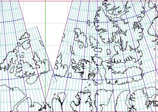
Fig. 6 (below): To the west of Greenland, and straddling the octant-joint meridian of 110° W, is the large Canadian Arctic island of Melville.
Beta-1 divides the island into two pieces, and given its size, I decided to put it back together. It so happens that the territorial governments of Nunavut and Northwest Territories split control of the island along 110°; and since no one lives there, maybe I didn't have to bother. |
|
Beta-1:
Beta-2:
|
|
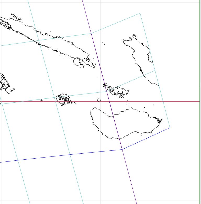
Fig. 7 (below): There is not enough room
along the eastern edge of Beta-2 to consolidate the Solomon Islands with
an extension, but I did at least put Guadalcanal back together. Also, Duncan
Webb, a Down Under
collaborator on this map, may prepare a version which links the South Pacific
octants instead of the South Atlantic ones, in which case those Pacific Islands
can be seen all together, along with New Zealand.
|
|
|
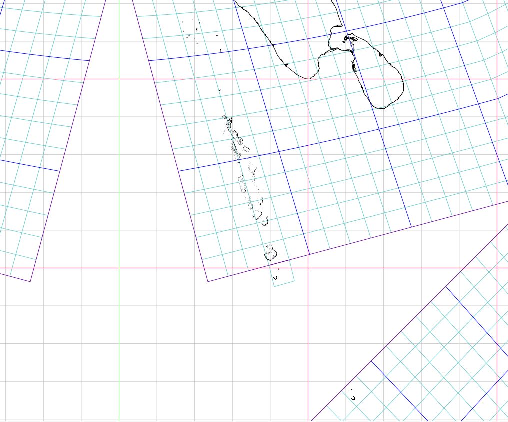
Fig. 8 (below):
The Maldives may be endagered by the rising ocean, but at least they will
all be together in the Beta-2. This screen grab from a pdf is 1/10 M, if
the small grid squares are 20 mm wide. One extra geocell was needed to round
out the chain.
|
|
|
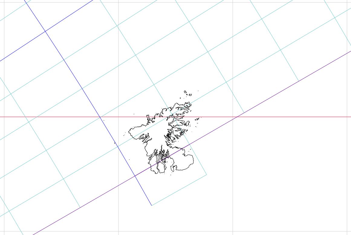
Fig. 9 (below): Way south of Africa
in Octant 8, little Kerguelen Island hangs out over the edge, likewise needing
one more geocell to finish it. Scale here is 1/2 M, if the large grid squares are 100 mm wide.
|
|
|
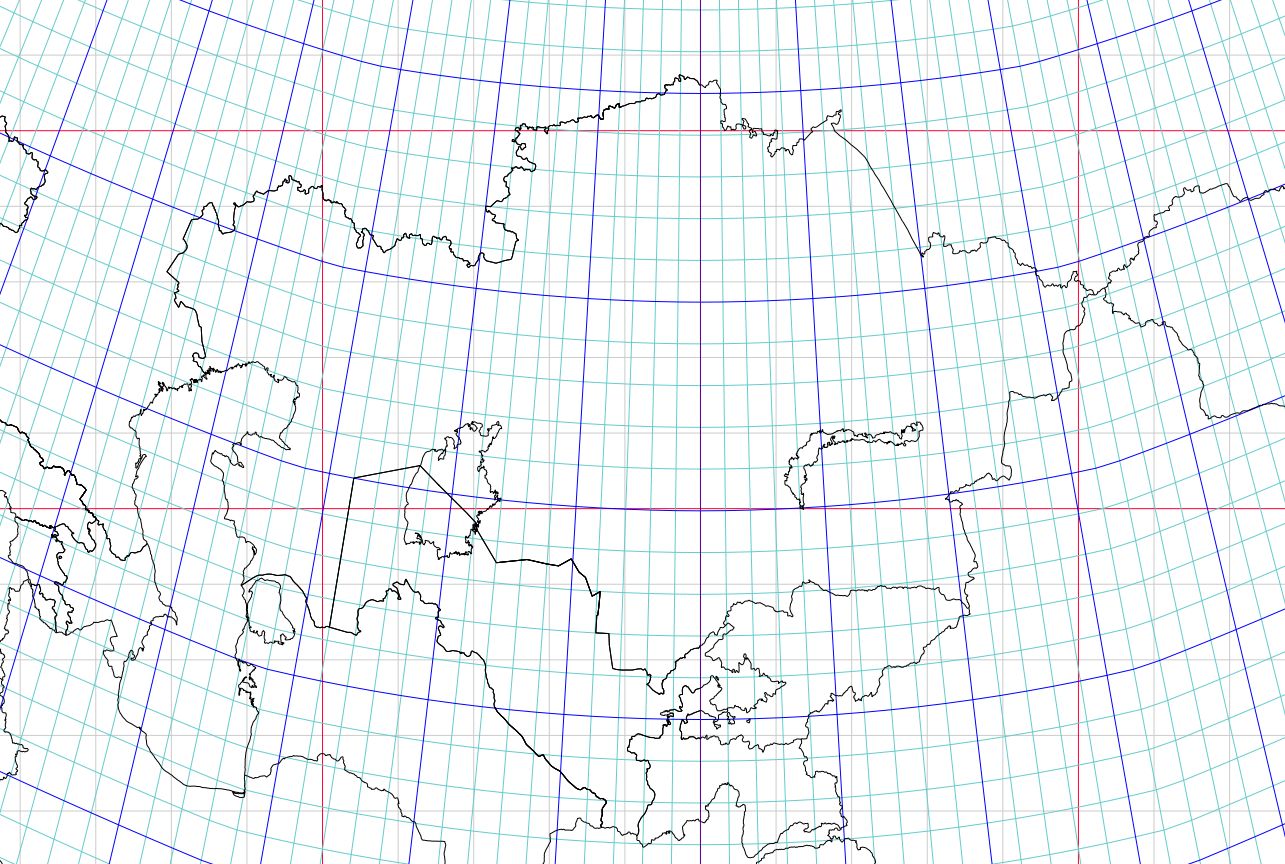
Fig. 10 (below): This cut indicates
some updated borders from Duncan Webb, especially around the former Soviet
Union, plus seas and big lakes which were lacking in Beta-1. It also shows
how Kazakstan and other countries in the Eurasian heartland (or in Western
North America), tend to have a more "perpendicular" set of meridians, according
to the "standard" M-layout of Cahill-Keyes. Of course, the octants can be
assembled and oriented many different ways, including Cahill's original Butterfly.
But for the purposes of the Megamap and all its systemic derivatives, I deem
"M" to be the most useful format.
Screen-grab is from a pdf at 1/10 M, whose small grid squares should be 20 mm wide. How many 'stans can you identify? I might miss a few on a test. |
|
|
Appendix 1: Proof-of-concept images showing how Mary Jo Graça's Perl script
can enable a vector draw application [e.g., Apache OpenOffice Draw] to attach
the octants at any of their edges in any layout. (This was a by-product of
her method to rotate in the Antarctica pieces, etc.) We did not run full
maps with continents and graticules in all these profiles (very time-consuming);
only perimeter variants with sketchy coastlines.
|
|
Appendix 2: Downloadable pdf's for 4 sizes of the Cahill-Keyes Multi-Scale Megamap, Beta-2. (As I keep repeating, these are all the same map, except for scale. Each is the original 1/1M which is scaled down; not a smaller one being blown up.) A desk-size version: 1/100 million 400 mm x 210 mm (ca. 16" x 9") 5 MB A wall map version: 1/50 million, 800 x 420 mm (ca. 31" x 16") 8 MB A very big wall map version: 1/10 million. 4 m x 2.1 m (ca. 13' x 7') 19 MB
|