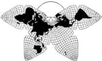
Cahill 1909
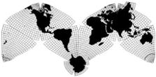
Cahill-Keyes 1975
|
Cahill 1909
|
Go back to Gene Keyes
home page
Cahill-Keyes 1975 |
|
Cahill Gallery 3
B.J.S. Cahill's Butterfly World Map: Five Desk Versions Gene Keyes
2011-04-12 2012-01-15 updated with fourth map 2015-03-30 updated with fifth map The five maps shown here at their original size are essentially from the same
base, first produced by Cahill in 1914. These somewhat-oversize desk versions
may comprise Cahill's earliest, and only, commercial printings of the Butterfly
world map, outside of his initial academic journal articles, (1909 and 1912.),
plus various newspaper and magazine cuts in later years, They are also his
largest published maps, though he had prepared some other even larger unpublished
drafts, and a wall map which C.S. Hammond backed out of printing in 1926.
He had also made a much bigger hand-colored wall
map, ca. 1914 (reproduced at full size
elsewhere on this website).
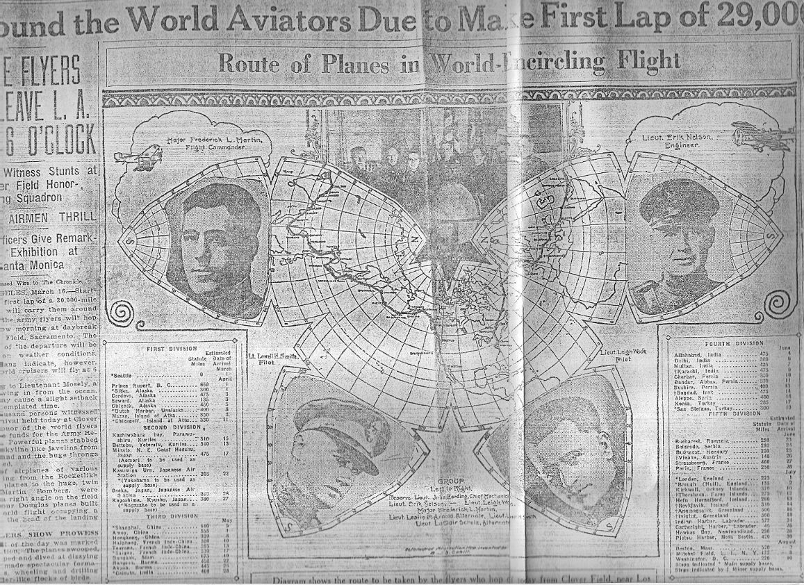
Unfortunately, the five sheet maps below are all in his worst configuration, the Eurasia-split, which runs counter to his intent of showing all continents whole. (Unlike, e.g., the Pacific version, seen upper left. Maybe it was too much for his clientele not to have USA in the center of the universe.) The map in Fig. 1 depicts a competition for the first round-the-world flight, planned in 1914, to have occurred in 1915. It would have been quite an event, but there was a nine-year delay, thanks to World War I. After failed attempts in 1922, it was not till 1924 that an American Army team succeeded. Those efforts too were shown in newspapers on Cahill maps similar to this one, including a front page version in the San Francisco Chronicle, 1924-03-17 (see last image in Appendix below). An odd thing about this first map, below, is its title word "Circumaviation" — that's aviation, not navigation — though I still tend to mis-read it as "circumnavigation". Unlike that describing Magellan, Cahill's term never caught on. (Wikipedia's article on the 1924 flight was titled "First aerial circumnavigation". Contemporary newspaper accounts did likewise.* A website about many such events, including the 1915 plan, calls them "Round-the-World Flights", or RTW.) *Source: clipping scrapbooks in Cahill archives, Bancroft Library, University of California, Berkeley.) |
|
Fig. 1.
Here is Cahill's first desk-map, 1914, post-dated for a 1915 world's
fair in San Francisco, and the base for his only other published medium-size
maps. It won a gold medal for cartography at that Exposition. By my scaling method, I deem this one to be 1/83.3 million.
Source: Duplicate original given to me in 1983 by Bancroft Library,
University of California, Berkeley. Scanned in four parts in 2011 and spliced by GK with ClarisWorks Draw. |
For a half-size view, click once. To restore full size, click twice.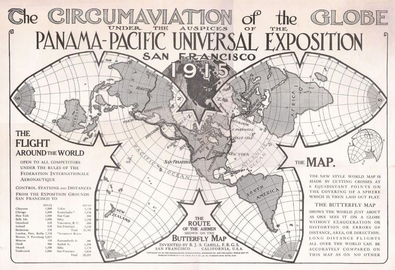
|
|
Fig 2: Thanks to a tip from Jacob Rus, I
found this one on the Boston Public Library website. Its download was a highly
excessive 54 MB, image four times too large; crooked, and probably mis-dated
by the site as 1910. I debloated the file to its correct 25%, — 3.6 MB — and
straightened it. A small hand-written date under the caption is "November
13, 1918", which seems more likely than 1910. This one is somewhat larger
than the others, and while its stated scale is 1/63,000,000, or 1,000 miles
per inch, by the calculation I use, I deem it to be 1/57,000,000. Note that the kind of map, and its creator, are not identified.
Source: Norman B. Leventhal Map Center at the
Boston Public Library, http://www.maps.bpl.org/id/15444 |
For a half-size view, click once. To restore full size, click twice.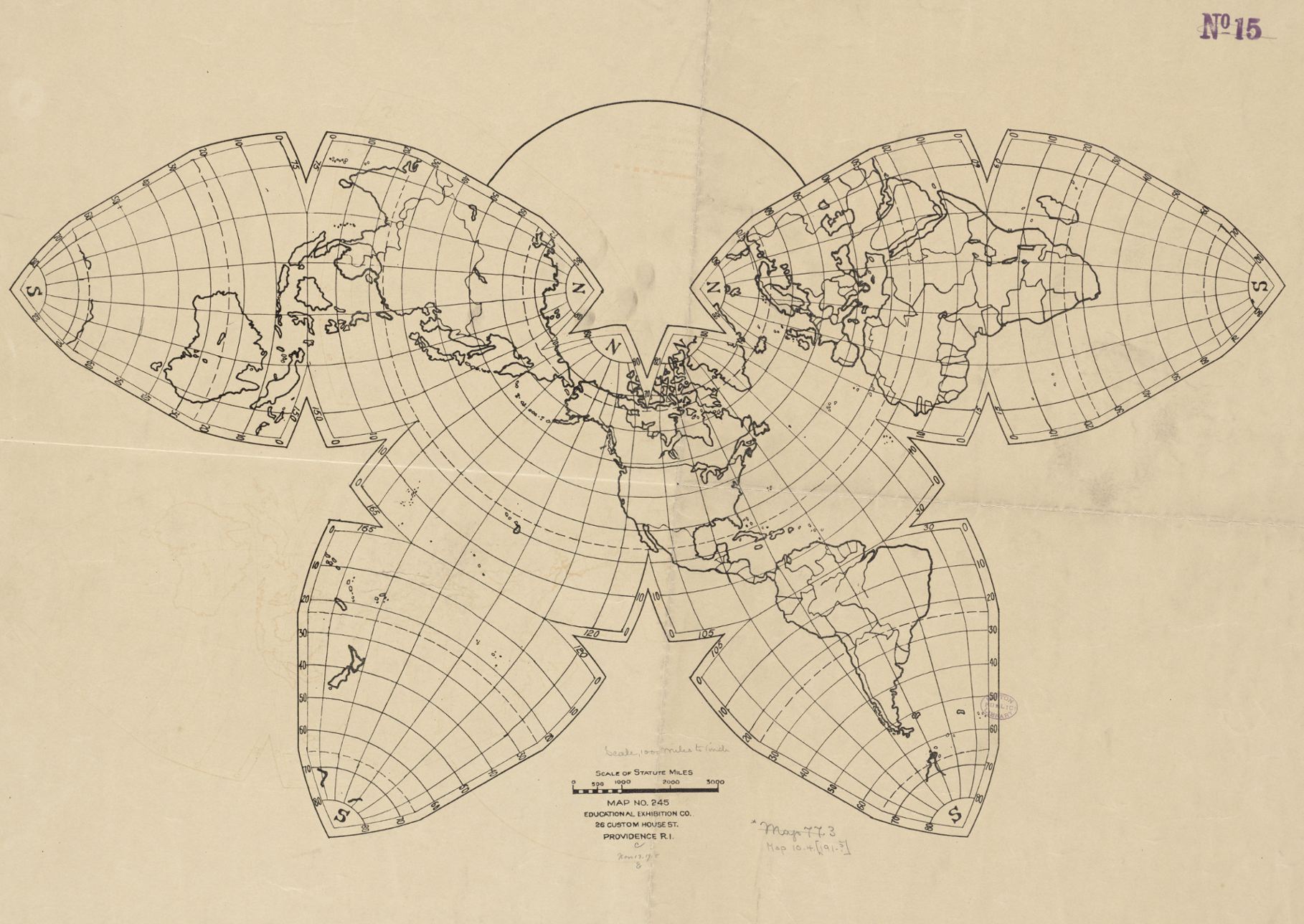
|
|
Fig 3:
Next is Cahill's desk map of the world "to the scale of a 6 inch globe". While I
regret its Eurasia-split version, I think this is his best layout in terms
of ancillary material: the orange diagram within the Butterfly triangles;
the sphere inside an octahedron, the arc of the globe size, and the drawing
with text of his rubber-ball principle. (For detail-enlargement of that last
item, see Fig. 2a below.) While a six inch globe is ca. 1/82.8 million, again by the calculation I use
the scale here is ca. 1/73.5 million, slightly larger than the following
one, due to photocopy expansion. (Undated; probably contemporaneous with
fig. 2 above.)
Source: Xeroxed in 3 pieces in 1983 by GK at Bancroft Library,
University of California, Berkeley; and spliced with Olfa cutter and tape. Scanned in 4 pieces in 2011 by GK and spliced in ClarisWorks Draw. All map imperfections due to multiple splicing. |
For a half-size view, click once. To restore full size, click twice.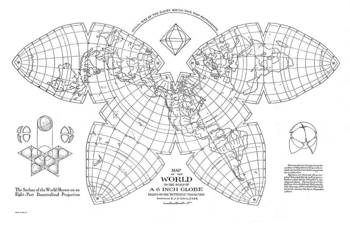
|
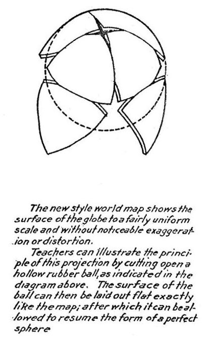
Fig. 2a: Enlarged detail from map above, showing Cahill's important
rubber ball principle. I thought the text in the original was too small, so I have blown it up for clarity.
|
|
Fig. 4:
Below is a map similar to Fig. 3 above, but without those edifying inset diagrams.
So far as I know, this may be Cahill's only Butterfly sheet map issued by
a mainstream publisher (apart from others printed by himself, or his abortive
Cahill World Map Co; or in fig. 2 above, the "Educational Exhibition Co.",
which did not identify him or the map..). To repeat: while a six-inch globe
would have a scale of ca. 1/82.8 million, by the calculation I use, I deem this map to be ca. 1/74.6 million. (Undated; ca. early 1920s.)
Source: Duplicate original given to me in 1983 by Bancroft Library, University of California, Berkeley. But rather than scan-splicing that light blue 16 x 22" sheet, I have scanned an 8.5 x 11" b-&-w photo reduction, also from the Bancroft Library, and re-enlarged it to the map's own full 20" width. |
For a half-size view, click once. To restore full size, click twice.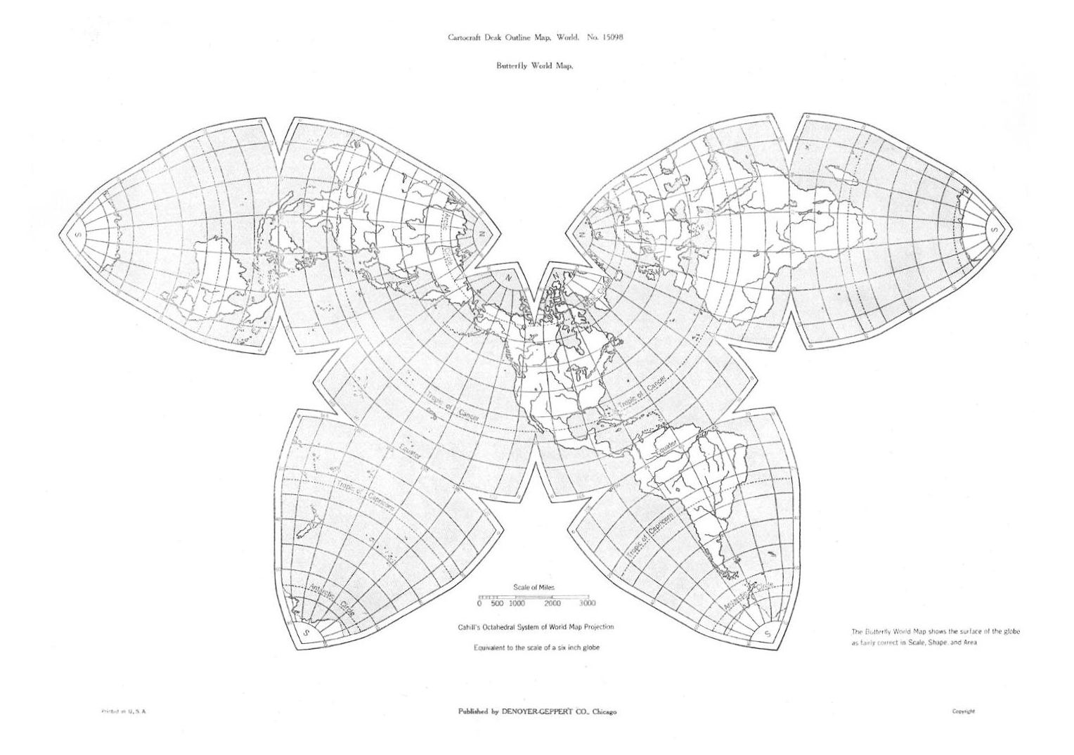
|
|
Fig. 5. "Port of San Francisco, Strategic Center
of World Trade", perhaps Cahill's only printed map in a semi-colored version. By my scaling method, I deem this one to be 1/95 million. According to the Bancroft Library Cahill [Map] Collection list, item 51, it was published in 1923 by the California State Printing
Office. The list also states "A variant appears in: Port of San Francisco, the gateway of the
Pacific: Sailing list and shipping guide / Issued by Board of State Harbor
Commissioners. 1922."
Source of image below: From the book Port City: The History and Transformation of the Port of San Francisco 1848-2010 by Michael R Corbett (2011); as scanned and photoshopped by Andrew Sherman, 2011-12-03: http://www.flickr.com/photos/andrew_sherman/; used with his permission. Resized by GK to approximate the original |
For a half-size view, click once. To restore full size, click twice.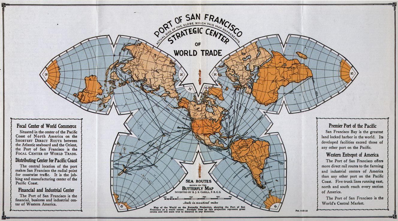
|
|
Appendix: This is from the front page of the San Francisco Chronicle,
1924-03-17, perhaps the high-water mark in public visibility of the Cahill
Butterfly world map. In tiny print at the bottom it says "Octahedral Projection
map invented by B.J.S. Cahill". Readers may have been paying more attention
to the event than to what kind of map . . .
Source: Xeroxes of scrapbook at Cahill archives, Bancroft Library,
University of California, Berkeley. Spliced by GK in 1983; scanned in 2011. |
|