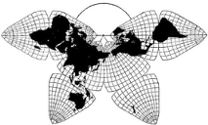
Cahill 1909
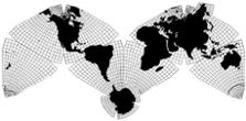
Cahill-Keyes 1975
|
Cahill 1909
|
Go back to
Gene Keyes home page
Cahill-Keyes 1975 |
|
Why Cahill? What about Buckminster Fuller?
Evolution of the Dymaxion Map: An Illustrated Tour and Critique Part 9.3 by Gene Keyes 2009-06-15 CONTENTS
Click inside boxes to open other sections in separate windows. 9) Critique: Seven Design Flaws of Fuller's
Map as Compared to Cahill's
|
|
Part 9.3
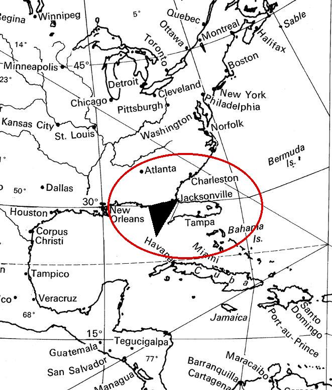
The East Asia and Scandinavia Distortions Fig. 9.3.1 below: If you saw a world map
in which Florida looked like this, would you call it "undistorted"?
Hardly.
|
Source: [1967?] outline wall map, 1/21,000,000
R. Buckminster Fuller and Shoji Sadao, cartographers. © 1954, 1967 by Buckminster Fuller Florida adapted, and portion scanned by Gene Keyes. |
|
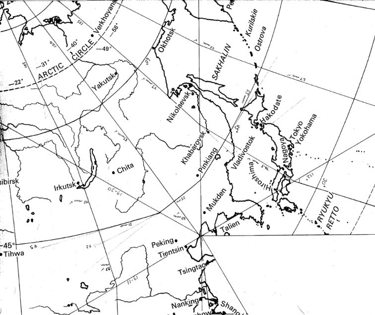
Fig. 9.3.2 below: But that is just what
the Dymaxion icosahedral map does to Korea, a north-south peninsula
of similar extent, shown again here from the same map at the same scale,
1/21,000,000:
|
Source: [1967?] outline wall map, 1/21,000,000
R. Buckminster Fuller and Shoji Sadao, cartographers. © 1954, 1967 by Buckminster Fuller Portion scanned by Gene Keyes. |
|
It was the Korea and East Asia distortion which
for me proved the undoing of the Dymaxion map. At a small
scale, one hardly notices it. At 1/21,000,000 (above), it
becomes more glaring. Then I drew, by hand, a four-square-meter
blow-up of that area, at 1/1,000,000, What a mess! That was
when I began to see how bad the graticule looked at such a large
scale in that area, and also how bad the Dymaxion graticule is in
general.
The problem is that one of Fuller's so-called sinuses entered and dilated China's Bohai Sea, and dislocated Korea away from the Asian mainland by 60º. I have already shown how East Asia should look, in the orthographic map and globe pictures on the previous page, Figs. 9.2.7 and 9.2.8. Reprised below are the same three map excerpts in smaller scale: the cracked-mirror 15 degree graticule in Fuller's, on the right, compared to the regular 5-degree graticule of Cahill's, on the left: |
| To review the
Korea distortion and Florida comparison (sources same as above, and
reduced to 1/50,000,000): |
Fig. 9.3.3 below: Cahill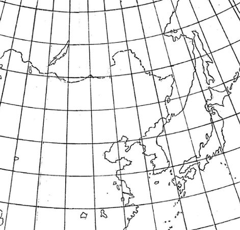
|
Fig. 9.3.2-b below: Fuller
|
|
As mentioned, if it was Florida, this distortion. would be unacceptable. It so happens that Florida is a peninsular land mass of similar extent to Korea. Consider what becomes of Florida on the same map at the same scale, if that state were dislocated away from the US mainland by 60º: (I could have done the same thing to Nova Scotia, where I live — upper right on this map, between "Montreal" and "Halifax" — but Florida makes the point.) |
Fig. 9.3.1-b below: Fuller, adapted by Keyes
|
|
This defect was a severe impediment for me, because
my MA thesis contained 49 maps of the joint history of China and
Russia, and I had intended to use the Dymaxion as the base map.
Because of that ruinous rupture, I decided at the last minute,
to replace it with an interim orthographic globe-like map, marked
as if Fuller-icosahedral. But that spoiled my aspiration for a
single all-purpose all-world map with good fidelity to a globe.
— Until I saw (too late for my thesis) that Cahill had already accomplished in toto what I had sought, and what Fuller had missed. |
|
Fig. 9.3.4 below: Not that the Korea
flank is the Fuller map's only sore spot. At the other end of the
same triangle, we bump into Norway and northern Europe, which also exhibits
a tortuous dispersion of its graticule:
|
Source: Dymaxion Map as drawn by Eric Gaba, Wikimedia Commons http://en.wikipedia.org/wiki/File%3AFuller_projection.svg (svg file converted to jpeg, marked and reduced by Gene Keyes.) |
|
Fig. 9.3.5 below: A close-up of Scandinavia,
from a 15º graticule World Game map, 1/21,000,000, which
I hand-enhanced with a 5º and 1º graticule in 1974. Strangely
enough, in 1954 Fuller had used the expression "runover porcupine"
in reference to other maps; but that is just what we have here. Norway
and Sweden, like Korea, suffer a big bend; which in their case, dislocates
the southern portions from their northern parts..
|
Source: excerpt from [1967?] Dymaxion Map:
same one as Figs. 9.3.1 and 9.3.2 above and Fig. 6.8 in Part 6, except in this copy, 1º graticule added by Gene Keyes in 1974; scanned and slightly enlarged to 1/20,000,000. R. Buckminster Fuller and Shoji Sadao, Cartographers © 1954, 1967 by Buckminster Fuller |
|
The Korea / Norway problem brings to the fore
the next defect of the Dymaxion map: its poor scalability.
|